 Catchable
How Catchable reads the rules, and where it can be wrong.
Catchable is a reading of the official rules, not the rules themselves. This page says where the reading comes from, how often it is checked, what happens when it is not sure, and what leaves your phone.
Where the rules come from.
Salt water rules come from DFO fishery notices and DFO's area pages for the Pacific region.
- Salt water
- DFO fishery notices and DFO tidal water area pages.
- Counted
- 610 tidal subareas and 135 salt water fish and shellfish listings, as of .
As of 5 November 2026, Catchable held 162 rockfish conservation areas, 29 DFO area pages and 988 shellfish closure zones.
How often it checks.
Catchable reads DFO notices about once an hour through the day, Pacific time, plus one safety run each day.
A refresh that fails its checks is rolled back.
Every card shows how old its source is. If no check has succeeded in 24 hours, the app warns you.
Checking every hour is how often we look, not a promise that nothing changed in between. A notice can take effect before we read it.
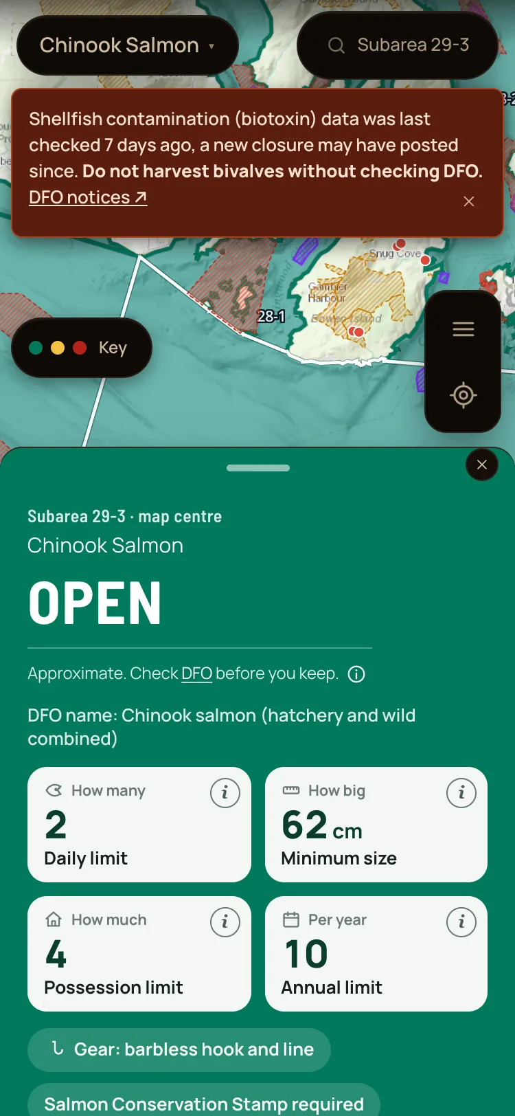
Subarea 29-3
Chinook salmon Yes, keep it
The card gives the limit and the size for this subarea.
Captured in Catchable on . Map: Esri, USGS, NOAA, and OpenStreetMap contributors.
What the colours mean.
Four colours, each with its word. Most cards show DFO's own word: OPEN, NON-RETENTION or CLOSED. Some show a plain word, such as Keep or Ask first. The colour and the Key put it in plain words:
- Yes, keep it
- Catch and release
- Ask first
- Seasonal
- No fishing
Yellow covers Catch and release and Ask first. Neither one is a plain yes.
When it is not sure.
When Catchable cannot confirm a rule, the card says Ask first and points you to the official notice. It never turns green on a guess.
We have shipped false opens before. This rule is what we learned.
Salt water.
On the coast, DFO splits the water into numbered areas and subareas. The card names the subarea it read.
Lakes and rivers are not covered yet. Tap one and the app says freshwater rules are coming later.
When a boundary is unclear, the answer leans cautious. Some waters are not mapped yet.
What leaves your phone.
- Your saved spots, catch log, trips and licence photo stay on your phone. No account needed. There is no backup, so clearing the app's data clears them.
- Usage events go to PostHog with a random ID, never a name, a coordinate or a spot. PostHog sees the IP address of each request. For usage events, no cookies are set.
- When you tap for weather, the coordinates of the point you tapped, rounded to about 1 km, go to MET Norway and Environment and Climate Change Canada, which also see your IP address.
- Tides send only the id of the station you picked.
- Map pictures and depth layers come from Esri and DFO map services, which see your IP address and the map area you look at.
- The Windy link shares the point, rounded to about 1 km.
- There is no ad network and no data broker.
What it does not do.
- It is not for navigation. Depth, tide, wind and the shelter estimate are approximate.
- It does not identify a fish from a photo.
- It does not sell licences. The licence lesson shows where to buy them.
- It is not run by DFO or the Province of BC, and it is not affiliated with any government body.
- Some waters are not mapped yet. Where a boundary is unclear, it leans cautious.
Who runs it.
Catchable is operated by 33knots. It is not affiliated with Fisheries and Oceans Canada, the Province of BC or any government body.
Found something wrong? Report a problem inside the app. No account needed.
Rules data is used under the Open Government Licence. Map data is from OpenStreetMap contributors, under the OpenStreetMap data licence (read the credits).